

")


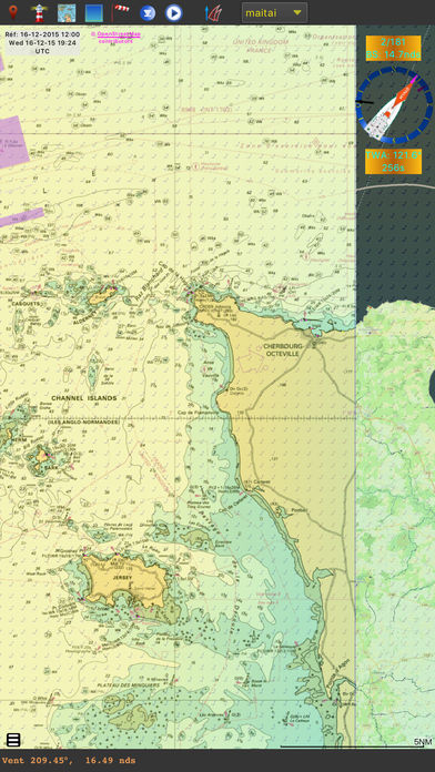
qtVlm is a navigation software designed for sailing boats. It is also a free weather grib viewer that accepts all kinds of gribs. It can read and display charts in various formats: Vector charts (S57 and S63), Raster charts (kaps, geotiff, etc), Visit My Harbour charts and mbtiles charts.
|
You'll find there S63 User Permit, our paid applications (iOS, Android, Windows Tablet) and our vectorial charts packs derived from various hydrographic services and organizations. |
 |
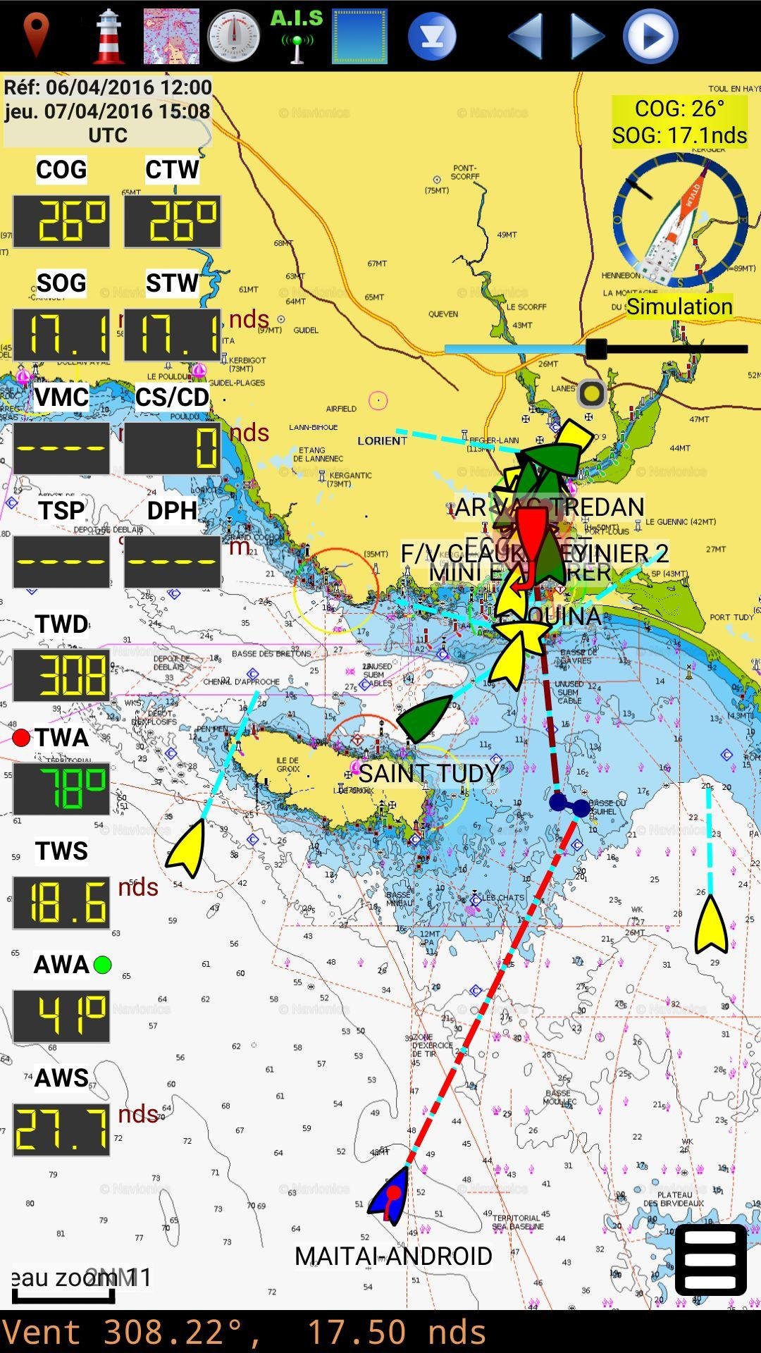
qtVlm is certified Iridium GO! and can also access directly to your Great Circle (squid) grib subscriptions. It includes an AIS module (with the possibility to retrieve targets via Internet) and an Instruments Module, that can acquire data from various NMEA sources, or from internal GPS. It can also send performance data (VMG, target speed, etc) to a navigation system or exterior repeaters. It can also send data to qtVlm Companion, an Android and Android Wear application specially designed to interact with qtVlm.
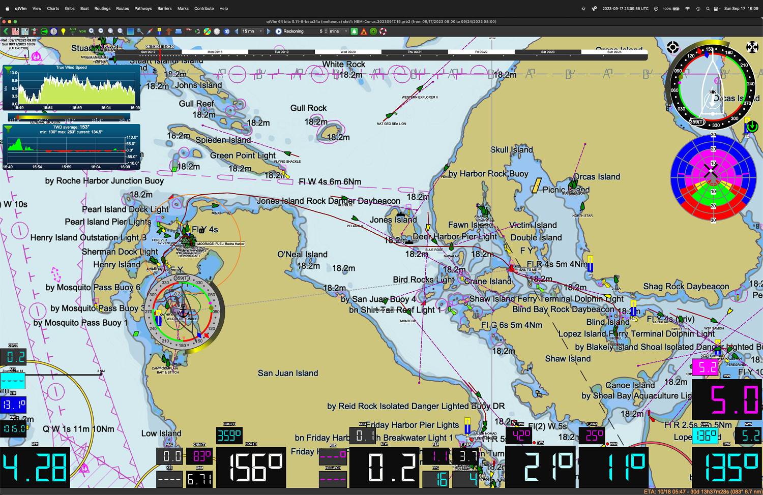
qtVlm calculates the best course using Routes and Weather Routings modules. Many options are available, like multi-routing to find the best departure date-time according to various parameters, routing on a pathway, or taking into account segments with engine. Winds, Currents and Waves plus some other weather variables are used during the calculation. Boat performances can be tuned very precisely, for instance polar efficiency during night, or time needed to tack or gybe. Several grib files can be loaded at the same time, in order to be able to route using various parameters (winds, currents and waves for instance), or to compare grib models. Weather faxes images can also be loaded on top of gribs. |

|
A Start Line Mode manages a regatta start line with chronometer, distances and times calculations, and displays a safe zone. qtVlm can also be used In Simulation Mode. In this mode qtVlm will use wind and currents data from grib to simulate navigation. All instruments will be usable, and real live AIS targets are received from Internet. Beware not to collide with a real fishing boat or another qtVlm boat! qtVlm is free for Windows, MacOS, Linux and Raspberry. There is also a free basic version for Android, iOS and Windows tablet, which can be unlocked to full version through in-app purchase. You can also found some useful polars here |
 |
Member of Pole Mer Bretagne Atlantique:
![]()